Travis County Cemetery Project
In the last part of the 20th century, Kay Boyd and Jean Shroyer initiated the Travis County Cemeteries Project, enlisting other members to visit the 275 Travis County Cemeteries. The result of their combined efforts was an accurate listing of gravesites at 250 of the cemeteries, some with as few as two graves, and some with as many as 15,000. It was a monumental undertaking over years, resulting in databases that serve researchers locally, nationally, and internationally.
Guidelines for Cleaning Tombstones
Guidelines from the Texas Historical Commission
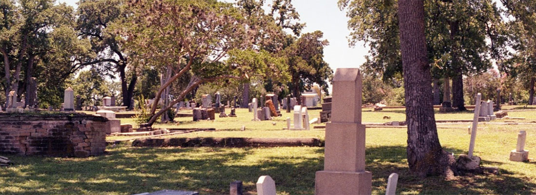
Submitted Photos
Photographs of Travis County Cemeteries from Sharon Morrissey and Andrew Butler
Travis County Cemetery Master List
A – D | E – I | J – L | M – Q | R – Z
| CEMETERY NAME | DATE TRANSCRIBED | DIRECTIONS |
| Alexander Cemetery Index also referred to Pilot and Cottonmouth | 2007 | Located on 183S, 3.6 miles from the intersection with 71. Immediately south of Cottonmouth Creek on the right. |
| Anderson’s Farm Cemetery | 4/1/2008 | Off of Derecho Drive on private property |
| Allen-McNeill Cemetery | 2001 | River Hills Road, 2 mi North of Bee Caves Cuernavaca Dr. N. |
| Assumption Cemetery | 2/1/2002 | NOT part of the AGS cemetery project. This link will take you off the AGS website. 3650 IH-35 South. From S-I35 take Ben White exit, entrance to the west. |
| Austin Family, Charles F. Austin Cemetery Index | 4/1/2002 | 8505 Hillmoore Rd. Corner of HWY 183S and Hillmoore. |
| Austin Memorial Park Cemetery | 2/1/2004 | 2800 Hancock Dr. Historical Marker. |
| Austin State Hospital Cemetery | 2000 | The cemetery is off 51st Street. Between Lamar and I35.. Historical Marker. |
| Austin State Supported Living Center (formerly known as Austin State School) | 3/1/2014 | 2203 West 35th Street. (Some residents were buried at the Travis State School.) |
| Baker Ranch Cemetery | 4/1/2007 | 12308 Lime Creek Rd. Cemetery is behind a gate on the north side of Lime Creek Rd. |
| Banks-Woods Cemetery | 2008 | 21327 Blake Manor Rd, about a mile past the electrical grid distribution plant, and it will be on your right. Must enter through private property. |
| Barton Springs Baptist Church Cemetery | 2/1/2006 | The cemetery is behind the church at 2107 Goodrich Ave. |
| Bassford Cemetery | see Dittmar-Bell Springs-Bassford Cemetery | |
| Beck, Carl Cemetery | 9/1/2000 | 14301 Hwy 71 W. in Bee Cave, TX. Across from White Rock cemetery. This is private property and permission from the family must be obtained before entering. Historical Marker. |
| Beck, Joseph Cemetery | 10/1/2002 | 3100 RM 620, north of Bee Cave. Located off Hwy 620 S about 1.5 miles north from the intersection of Hwy 620S and Hwy 71W, 3 miles west of 620. Private cemetery. |
| Bedford Memorial Cemetery | 13904 FM 969, Austin 78724, on private property. Listings on findagrave.com | |
| Bee Cave Baptist Cemetery (includes Elmer Hudson & Marshall) | 2006 | 1320 TX 71 W (Bee Cave Rd.) Located on the corner of Hwy 71 W. and Hwy 620 behind the Bee Cave Baptist Church |
| Berryman Cemetery | 7817 TX 71 W.78735. About 1 mile west of the Hwy 290/71 intersection, south of Hwy 71 at Scenic Brook Dr. No markers remain. | |
| Bethany Cemetery | 1308 Springdale Rd. Historic marker. | |
| Bethlehem (Lund) Cemetery | 8/1/2000 | Lund Carlson Rd. in Lund. Take 290 east. Turn left on FM 1100 and go 3 miles to Lund Cemetery. |
| Bluff Springs Cemetery | see Smith-Runkle | |
| Bohls (N) Cemetery | 8/1/2008 | 121_US 71 W, Bee Cave. About .5 miles north of the Bohls Cemetery South. The cemetery is about 100 yards from the highway and under a large oak tree. Private property and need permission from the Bohls. Graves are surrounded by a stone and chain link fence. |
| Bohls (S) Cemetery | 8/1/2008 | 114_TX 71 W, SE of Bee Cave. On the east side of Hwy 71 W where the highway crosses Barton Creek. Private property, need permission to acces. The cemetery is encompassed in a 4-foot concrete stone fence. |
| Bouldin Cemetery | 14__S. 6th Street, Austin. Becker School was built on top of this cemetery. Located on the west side of Bouldin Avenue. No longer exists. | |
| Bowles, J. W. Cemetery | see Dan Brown cemetery | |
| Boyce Family Cemetery | 2/1/2012 | 5121 E. Howard Lane, Manor. |
| Bridges Cemetery | 4/1/2014 | F.M. Rd 1626. On Marbridge Ranch, Manchaca |
| Briggs Cemetery (name changed to Gray Family Cemetery) | Near the community of Nameless, Travis County, TX. It is “off road” east of Nameless Road, about 1700 feet east of the intersection of Nameless Road and Lindeman Road. It is east of Big Sandy Creek. It is a recorded cemetery with the Texas Historical Commission. Coordinates: 30.52118, -97.91989. | |
| Briggs, Avery Cemetery | 199 Lindeman Lane; South side of Lindemann Lane, west of Nameless Road. | |
| Brown Cemetery | 708 Castle Ridge Road, 78746. On right side between buildings 710 and 702. The cemetery is set back off the road. | |
| Brown Cemetery – Twin Creek | 1/1/2009 | I-35 S to exit at FM 1626 to the west. Turn left on Twin Creek and then left on Elm View Way. Cemetery is on Elm View Way and Twin Creeks Rd., the first dirt road on Elm View Way on the left is the entry to the cemetery. The cemetery is among the trees on the corner. |
| Brown, Dan Cemetery | Near the end of Old Ferry Road where the road forks. This grave is in front of a house; Dan Brown, April 27, 1919, Here Lies an Honest Man, Rest in Peace. Mr. Brown once owned the property. He did not want to show partiality between his two wives so he was buried halfway between his one wife in the Collier Cemetery and his other wife near Spicewood. | |
| Brown, H. Cemetery | 136 __E. FM 969, Austin. Before reaching the Hornsby School the cemetery is .25 miles off the road. | |
| Brown, Ike Cemetery |
7900 Brown Cemetery Road, south of Burleson Manor Rd. It is the last cemetery on the road. Find cemetery information at FindAGrave HERE. |
|
| Brown, Jerry (W) Cemetery | 1977 | 79 — Burleson-Manor Road, south of Manor. Cemetery is on west side of the road. |
| Burch-Vance Cemetery | 6/1/2000 | Take Hwy 183S, turn left on FM 973 and go about 1.3 miles. The cemetery is on the left. |
| Burditt/Burdett Prairie Cemetery | 2009 | 6700 Felix Avenue, Austin. Historical Marker. |
| Burleson-Rogers Cemetery | East on FM 969/Webberville. Located next to Rogers Hill Cemetery, west of Decker Lane. | |
| Caperton Family | 3/1/2007 | 8321 Thaxton Road. On a bluff about 270 paces north of the fence/gate north of private property. It is near the intersection of Thaxton Road and Colton-Bluff Springs Road. Historical Marker. |
| Cook-Walden Capital Parks |
14501 North IH-35 on east service road near FM 1825. Privately owned. Listings can be found on FindAGrave. |
|
| Carl Cemetery | 1/1/2008 | 11508 Carl Road, north of Creedmoor. Located west of 1625 on Old Lockhart Road. |
| Cedar Mountain Cemetery | Reinterred to Fiskville, Bee Cave, Oak Hill, Cedar Valley, Old Bee Cave and Fitzhugh. | |
| Cedar Valley Cemetery | See Oliver Cemetery | |
| Center Union Baptist Cemetery | 5/1/2006 | Take 183 south; turn right on Hwy 21 and go to CR 177. Turn right .4 miles. Turn right and go to the church. On Williamson Rd. The cemetery is 200 feet past the church on the right side of the road. This is a African-American Cemetery. |
| Chandler-Drake Cemetery | 1977 | Go east on Hwy 290 E past Manor. Turn right on Voelker Ln. Turn right on Ballerstedt Rd. This road runs into Littig Rd, turn left to Littig. Turn right on Bitting School Road. Cemetery is on the top of Scott Hill on private property (in 1977 owner was Mr. Payne.) |
| Chote Cemetery | 6207 Idlewood Cove. The cemetery is fenced. | |
| Collier Cemetery | 7/1/2009 | FM 2322 at Cat Hollow Drive in Briar Cliff, behind the PPOA building. A wooden privacy fence hides the cemetery from the road. |
| Collins Cemetery | 3/1/2007 | Hwy 183S to Cottonmouth Rd. On Cottonmouth School Rd off Scenic Loop, African-American Cemetery with Historical Marker. |
| Comanche (N) Cemetery | 3/1/2009 | East on 71 for 4.2 miles to Garfield. At crossover take right on Albert Brown Drive. Drive .1 miles and then turn left on Caldwell Lane. Drive 1.3 miles and cemetery will be on left (west) side of road. |
| Comanche (S) Cemetery | 3/1/2009 | East on 71 for 4.2 miles to Garfield. At crossover take right on Albert Brown Drive. Drive .1 miles and then turn left on Caldwell Lane. Drive 1.3 miles and cemetery will be on left (west) side of road. This is a African-American cemetery. Adjacent to the north cemetery. |
| County Cemetery | 14510 Wells School Road. | |
| County Poor Farm | There was likely a cemetery at the Poor Farm when it was in operation. The Farm was originally located south of Camp Mabry. Possibly in the area of Mopac and Tarrytown Park, area including Westover Road, Tower and Indian Trail may be built over the area. Exposition Blvd. runs along the original western boundary of the poor farm. | |
| Creedmoor Cemetery | 8/1/2008 | 183S, turn right on Old Lockhart Road. Go about 2.5 miles past Aquaflex Dr. The cemetery is on the left, fenced with a sign. |
| Crosthwait-Miller | Re-interred at Texas State Cemetery. Originally north of Hwy 71 about 1.2 miles west of Montopolis Drive. | |
| Darter Cemetery | 15001 ½ Kollmeyer Drive. Take paved road to the left of Lake Travis Elementary School and go about 1.4 miles. The cemetery is on the left on a hill. | |
| Davidson-Littlepage Cemetery | 2001 | 1200 Bastrop Hwy. Located south Hwy 71 and 183. Cemetery is in a group of trees. |
| Davis, George W. Cemetery | 2/1/2007 | Vine Street between Cavileer Avenue and Twin Oaks Drive, Austin 78757. Private Property. Historical Marker. |
| Decker United Methodist Cemetery | 10/1/2008 | 8304 Decker Lane, adjacent to the Methodist Church |
| Decker Evangelical Free Church Cemetery | See Evangelical Free Church | |
| DeMaria Cemetery | 7200 Circle S. Road, Austin; this is a Hispanic cemetery. The cemetery is located east of South Congress in a residential area before reaching Masonic Cemetery. THC historic cemetery. | |
| Dessau Lutheran Cemetery | 9/1/2006 | 13300 Dessau Road, Austin. Historical Marker. |
| Dittmar-Bell Springs-Bassford Cemetery | 7/1/2009 | Located .6 miles east of the intersection of Hwy 71W and Old Bee Caves Road (2244) on Old Bee Caves Road. On Thomas Spring Road to the east. Go east about 1 mile and the cemetery will be on the north side of the road. |
| Duty-Webberville (S) Cemetery | 3/1/2009 | From intersection of 130 and 969 drive east on FM 969 to Webberville. Turn right (south) on Weber Street. Cemetery is in large pasture directly north of Webberville Ebenezer Baptist Church (located at 1314 Weber Street). Iron fence around Nash and Duty graves while headstone for Glover is located a few feet west in open pasture. Has a THC marker. |
| Eanes Cemetery | Camp Craft Road off Bee Caves Road (2244), West Lake Hills. Locate across the road from Eanes Elementary. Ask permission from the school to enter. THC historic marker | |
| Easley Cemetery | 2/1/2006 | 7800 Brown Cemetery Road, off Burleson Manor Rd. , the first cemetery, This is a African-American cemetery. |
| Elroy Baptist Cemetery | see Moline Swedish Lutheran Cemetery | |
| Elroy Free Church Cemetery | See Swedish Evangelical Free Mission Cemetery | |
| Elroy Lutheran Cemetery | See Moline Swedish Lutheran Cemetery | |
| Elroy Mexican Baptist Church Cemetery | North side of Williamson Road, south of Creedmoor before reaching the junction of Glass Road. Latitude: 30.0539, Longitude: -97.72818 | |
| Elroy Swedish Baptist Cemetery | 11/1/2006 | From the intersection of U.S. 71 and U.S. 183, go south on U.S. 183 4 miles, turn left on FM 812, go 4.8 miles to the church. |
| Enochs Family Cemetery aka Steiner Ranch Cemetery | 3/1/2004 | Located on Medina River Way in Steiner Ranch. FM 2222 to Hwy 620 to the Steiner Ranch Road. Travel south on Quinlin Park Rd. Turn around at Shore Vista drive and park on the west shoulder of the road headed back north about 200 north of Shore Vista Dr. |
| Episcopal Church of the Good Shepherd Columbarium | 12/1/2009 | 2209 Exposition Blvd. at Windsor Road |
| Evangelical Free Church Memorial Garden | 10/1/2006 | 10309 Decker Lane, .5 miles south of US 290. THC historic marker |
| Evelyn Cemetery | 9302 Evelyn Road, from 183S turn left onto Evelyn Road and go 1.1 miles. The cemetery is on the left, visible from the roadway. | |
| Evergreen Cemetery | E. 12th Street and Airport Blvd. | |
| Fairview Cemetery | (see Nameless) | |
| Fallcreek Cemetery | Located on the south side of Hwy 71 W, 3 miles past the Pedernales River Bridge on the left. TX 71 at Fall Creek Road, west of Briarcliff. There are 272 recorded graves. http://www.fallcreekcemeteryspicewood.org | |
| Fiskville Cemetery | 2003 | Located on Fiskville Cemetery Road. From Rundberg Lane turn south on Crown Ridge Road. Turn right and go 1 mile to cemetery. Historical Marker. |
| Cook-Walden Forest Oaks (formerly Memory Park) | 6201 US 290W at W. William Cannon. | |
| Cook-Walden Forest Oaks Chapel Garden | 5/1/2010 | 6201 US 290W at W. William Cannon in Austin. |
| Cook-Walden Forest Oaks Garden of Hope | 3/1/2010 | 6201 US 290W at W. William Cannon in Austin. |
| Cook-Walden Forest Oaks Garden of Memories | 7/1/2011 | 6201 US 290W at W. William Cannon in Austin. |
| Cook-Walden Forest Oaks Garden of Rest | 7/1/2011 | 6201 US 290W at W. William Cannon in Austin. |
| Foster, J. L. Cemetery | 7135 E. Ben White Blvd, Austin, 78741. | |
| Fowler Cemetery (aka Buck-Fowler) | 3/1/2005 | East on 71E (toward Bastrop) Turn left on Buck Lane. Cemetery is on right approximately 300 feet east of intersection of Buck Lane and Highway 71 under canopy of trees. |
| Fowler I (Garfield) Cemetery | From Highway 71 and Toll Road 130 intersection, head east on 71E (toward Bastrop) for 3.2 miles. Turn right on Richards Drive. Cemetery is .01 mile on the left. 30°11.314N, 97°34.411W | |
| Fowler III Cemetery (aka I. D. Fowler) | On Cuernavaca Drive, between Oestrick and North River Hills in West Lake Hills, and on the east side of McNeil-Allen Cemetery. 2.6 miles off FM 2244 (Old Bee Caves Road). 12 graves. | |
| Fowler IV (Schneider/Grumbles) Cemetery | See Grumbles Cemetery | |
| Freedman Cemetery | see Waters Cemetery | |
| Freitag Cemetery | 3930 RR 620 South, from 71 W, turn right on RR620. 2 mi, turn left and travel 1.2 miles. Cemetery is in the left. 30 18’ 39N 97 56’ 55.5W | |
| Garfield (Fowler I) Cemetery | See Fowler I | |
| Giles-Jourdan Cemetery | See Jourdan-Giles Cemetery. | |
| Gilleland, James Cemetery | 2009 | 4600 block North Dunlap Road, about 50 yds to east of the road. 30.14.13 N, 97.34.5W. |
| Givins Infant | Located 200 yards from the intersection of Montopolis and Burleson Road. This is the infant son of T.P. and L.M. Givens who died Nov. 5, 1844. Relocated by SWCA in 1996 to Oakwood Cemetery. | |
| Glasscock I Cemetery | 18__ FM 969 E, east of Austin. Take FM 969 to Burleson Manor Road and FM 969. | |
| Glascock II Cemetery | 6/29/1999 | 6912 Old Bee Cave Road, .3 miles off 290W and .1 miles past the Oak Hill Cemetery. This cemetery is presently inside the fence surround Alamo Body and Paint. The cemetery is currently maintained by the property owners. There are 9 recorded graves. . |
| Good Shepherd Episcopal Church Columbarium | See Episcopal Church of the Good Shepherd Columbarium | |
| Goodrich Cemetery | See Barton Springs Baptist Cemetery | |
| Gray Family Cemetery (formerly Briggs) | Near the community of Nameless, Travis County, TX. It is “off road” east of Nameless Road, about 1700 feet east of the intersection of Nameless Road and Lindeman Road. It is east of Big Sandy Creek. It is a recorded cemetery with the Texas Historical Commission. Coordinates: 30.52118, -97.91989. | |
| Greenwood I | 2007 | 8600 E Riverside Dr. Take US 183 S past TX 71. Left. (E) onto Riverside Dr. Follow road up thru open gates to cem. |
| Gregg School Cemetery | 3/1/2006 | 5300 Gregg Lane. Take IH 35 to Howard Lane exit, go east. Howard changes to Gregg at Dessau. Continue about 2 miles. 5300 is on the left hand side. Address on mail box. |
| Grumbles Cemetery also referred to as Fowler and Schnieder Field. | 52__ Brodie Lane. Located behind Home Depot on the west side of Brodie Lane. Behind the stores on the right and the detention pond on the left. | |
| Hancock Family Cemetery | In the Steiner Ranch Subdivision. Off RR620 and the main entrance at Quinlan Park Rd. Intersection of Burks Lane and Burks Cove, on the right side facing east. | |
| Harrell Cemetery | Located on the Old Anderson Mill Road on Cypress Creek, about 2.5 miles east of Volente on the Old Harrell Place, near the Harrell swimming hole. Right beside Volente Rd., about 10′ from the pavement, on the left side of a dirt road going into Moore’s boat storage off of FM 2769. All the stones are gone, overgrown with brush, and graves desecrated a long time ago. | |
| Haynie Chapel Cemetery | 7/1/2011 | East on 71E to the crossover for Greenwood Drive, take left on Greenwood Drive and go .1 mi. Cemetery is at intersection of Houston and Greenwood. Across street from Haynie Chapel United Methodist Church. |
| Heffington-Perkins Cemetery | On Hamilton Pool Road, 2 miles south of Hwy 71W. The cemetery is on private property and permission must be obtained to enter. There are 10 grave sites. This cemetery is mapped but the location is not exact and a field guide will be required. . | |
| Hensel Family Cemetery | 2003 | Located on Post Oak Bend Road, west of Lago Vista in far NW Travis County on Singleton Road. After passing Lago Vista on FM 1431, look for sign to Travis Peak Church of Christ. This is Singleton Bend Road. Turn left and go less than a mile. There is a large two-story house. The cemetery is located on this private property on the west side of the road to permission must be obtained to visit. |
| Hickerson Hollow Cemetery | On the property of Buddie Grumble; the grave of a young girl named Hickerson. Her grave is surrounded by brush but can still be identified although there is no tombstone. | |
| Highland Park | Located in the NE corner of Evergreen Cemetery on 12th St. Many of the graves have been destroyed. These burials were all recorded by the Austin sexton. | |
| Hill Cemetery | 13652 Gregg Manor Rd, on the SW side of the road. North of Howard Lane. There is gate with the phone number of the property owner (512) 258-0427. Continue south to the next gate that is next to the wire mesh fence of the horse farm. | |
| Hornsby (Hornsby Bend) Cemetery | Listing on findagrave.com. Located off FM 969 E , east of Austin. Located near Hornsby Bend on a path that is off FM 969 about 300 feet to the west. The cemetery is located at the end of this path about 3000 feet south of FM 969. The turn off for this path is marked by a highway sign. There is a THC marker at this cemetery, on the south side of FM 969. | |
| Hornsby Mexican | 2008 | 183 to FM 969. Turn east and go 3.3 miles. The cemetery is on the right next to the Hornsby Cemetery behind locked gates. |
| Houston Cemetery | From the intersection of 183 and 71, drive east for 7.9 miles and turn left on Greenwood Dr. Road turns sharply to the right, continue on Houston Lane. Cemetery is on private land and no access is permitted (2007). Historical Marker. | |
| Huddleston Cemetery | Located off to the east side of Round Mountain Road about 2.4 miles north of Round Mountain, NW of Leander. | |
| Hudson Bend | Re-interred at Texas State Cemetery. Original location east on RR 620, from Hwy 71W, 7.8 miles to where the old RR 620 road angles off to the right. The road is not marked. This cemetery was started in the 1980s and there are only 7 graves. | |
| Hudson Bend (new) Cemetery | Near 4000 Double Dome Road. From the Intersection of RR-620 and Double Dome Road east of Lakeway, go 200 yards east on Double Dome Road. The cemetery is on the south side of the road. There is an entry gate with the name. 30 23.750″ N 097 55.280′ W | |
| Hunter (Hunter’s Bend) Cemetery | 159XX_ Hunter’s Bend Road, east of Austin. 7 miles from Webberville. 183 to FM 969. go 5.8 miles. Turn right on Hunter Bend Road and go .4 miles. Turn left and go .9 miles to the cemetery. | |
| Ike Brown Cemetery | See Brown, Ike Cemetery | |
| 500 Immanuel Road in Pflugerville adjacent to the church. | ||
| Ingram Cemetery | 2/1/2009 | From intersection of 130 and 71, go toward Garfield for 5.2 miles. Turn right (heading south) on Wolf Lane and go 1.6 Miles. Cemetery is on right (west) side of road about 200 feet from road up on a hill. Cemetery is across street from 6701 Wolf Lane. On private property. Ask for access permission to enter at 5100 Wolf Lane. 30°09’42.9″N 97°33’18.7″W |
| Ingram II Cemetery | 2003 | Lime Creek Rd., W. of Cedar Park |
| International Cemetery | See Travis County International | |
| Jackson Family Cemetery (Melvin Jackson) aka Nathan Woods Cemetery | 8/1/2010 | Mo-Pac and take the Rollingwood exit; Bee Caves Road and to Las Lomas Drive. Take Las Lomas to 700. There is a large wooden fence in the back and behind it are 2 African-American cemeteries; one is Jackson and the other is Woods. |
| Johnson Property | On the old Tommy Johnson property on Hamilton Pool Road near the stock tank are three graves. A slave and two ranch hands are buried here. Directions too vague to map. | |
| Jones Cemetery | 2/1/2013 | Hwy 183 to FM 969; turn east and go 6 miles. Turn left on Jones Cemetery Road and go about .4 miles to the cemetery. There are two cemeteries; east (Anglo) and west (Hispanic) |
| Jones Community Cemetery | see Jones-Norwood II | |
| Jones-Norwood I (Also known as Washington Family Cemetery) | 4/1/2007 | From the intersection of Hwy 183 and 71 go 5.1 miles to the east and turn left at the entrance to the Southeast Metropolitan Park. At the first intersection, turn right and go to the maintenance building and ask for directions to the cemetery in the northeast corner of the park. |
| Jones-Norwood II | 4/1/2007 | Take Hwy 71 east 5.1 miles to Ross Road, turn left and enter Southeast Metropolitan Park. Turn right at the first intersection and go to the maintenance building and ask for directions to the cemetery in the southeast portion of the park. |
| Joseph J. Manor Cemetery | Sandy Brown Lane. 19 miles SE of Austin. It is north of FM 969 and the intersection of Webberville Way and Sandy Brown Lane. Historical Marker. Also Manor Hill, Ruth Emanuel 512-303-7004, has family at Manor Hill Cem-( next to J J Manor), She has deeds and papers. is interested in getting it cleaned and documented. | |
| Jourdan-Giles Cemetery | 9/1/2006 | Turn east from Dessau onto Braker Lane, go .3 miles. The cemetery is on the south side of the street. The cemetery is enclosed with a chain link fence and a locked gate. Can be seen from the road. Before Pioneer Farm Drive. |
| Kimbro Cemetery | 9/1/2000 | Located on Manda Road, E of New Sweden. Off FM 1100, between Carlson and Wells. North side of the road. This site was visited by THC on 1/23/02. |
| Lakewood Cemetery | See Darter | |
| Lick Creek Cemetery | Located on Lariat Trail, W of Briarcliff. Could be the same cemetery as Wallace Family. Near the Wallace Family Cemetery | |
| Lindsey Cemetery | 6/24/2000 | Circle J Road, W. of Lago Vista |
| Littig | Go east on Hwy 290E past Manor to Ballerstedt Rd., turn to the right. Road dead-ends into Littig Rd., turn left. Follow to the community of Littig. Turn right on Bitting School Rd. Cemetery is .4 miles on the left. Signs to cemetery on Littig Rd and Bitting School Rd. This is a African-American cemetery. Historical Marker. | |
| Live Oak Cemetery | 3/1/2002 | 10739-10799 Twin Creek Rd, Manchaca. Lat: 30.1263°, (30° 7′ 34″)Lon: -97.8172° (-97° 49′ 1″) |
| Lockwood Cemetery | Take Blake Manor Rd east to Roadrunner View Rd and turn left. Follow Roadrunner to the split and turn right on the dirt road. The cemetery is on the right. Historical marker. | |
| Lohmann Grave | According to Milton Reimers, a young boy names Lohmann was searching for some oxen who had strayed. He was attacked by Indians and killed. He was buried on the riverbank on the Reimers property. This grave may have been moved. | |
| Lohmann’s Cemetery | Re-interred at Bee Cave Cemetery. | |
| Longview (Bargsley) Cemetery | 12/1/2003 | Finch Trail and Longview Park, south of William Cannon Drive and west of Manchaca Road, Austin. Go on Hwy 290 from Austin to Oak Hill. Turn left on Brodie Lane; go 3 miles to Davis Lane. It is marked Cameron Loop on left. Go until reaching Longview Road on the left. Go down Longview Road .5 miles. The woods begin at the fence line and the cemetery is 300 yards in these woods on private property at the rear of the park. |
| Lund Cemetery | 8/1/2000 | Hwy 290 to route 95, turn left, go 12 miles to County Line Rd., travel 0.9 miles, turn right onto Lund Carlson Rd, travel 0.9 miles, cemetery is on left |
| Manor Hill-J.J. Manor (Woods) | See Joseph J Manor | |
| Manda Cemetery | 9/1/2000 | 14212 Wells School Rd, Manor,78653. east of New Sweden, .75 miles north on Wells at corner of Well’s School. Cemetery is located on the north side of the road. Visited by THC on 1/23/02. |
| Manor Cemetery | Located on N. Lampasas Street in Manor. Take 290 E to Manor; turn right on FM 973 (Lexington Street); turn left on Parsons (Hwy 20) and go 4 blocks to Lockhart and turn left. Cemetery is at the end of the street. | |
| Marbridge Cemetery | See Bridges Cemetery | |
| Maria de la Luz Cemetery | See DeMaria | |
| Marshall-Eanes Cemetery | 4/1/2014 | near Eanes School Road 0.1 miles west of Camp Craft Road |
| Martin I | 4/1/2007 | From the intersection of Burleson and McKinney Falls Parkway, go south .3 mi on McKinney Falls and turn left on Shaw Lane. Go the the Austin Police Academy at 4800 Shaw. Permission is needed for access to the gravesite. There is a fenced enclosure that in 2007 was on the fence line dividing the Academy from cemetery property. |
| Martin Family (III) | 7/1/2009 | Cemetery is located southeast of 71E and 183S intersection. On northwest corner of Austin-Bergstrom International Airport. Approximately 140 feet north of Greenwood Cemetery. |
| Marx, Henry Cemetery | All bodies have been re-interred to Fitzhugh Cemetery in Hays County. (This link will take you off the AGS website). | |
| Masonic Cemetery aka Boggy Creek | 7491 Circle S Rd, 78745 Two blocks south of William Cannon and I-35 in Austin. Historical Marker. | |
| Maul Cemetery | 12/1/2007 | Located in Lakeway in Yaupon Creek development. From the intersection of RR 620 and Lohmans Crossing Rd. Turn off of RR620 and go down Lohmans Crossing a short distance until you come to Lohmans Spur. Turn left onto 2300 Lohmans Spur and about half-way up the road you will see the entrance to Yaupon Creek turn-in and make the first right turn The cemetery is protected by an adobe wall and wrought-iron fencing. The cemetery is on private property and a key must be obtained from the leaser of the property. This cemetery is mapped but this is an estimated location. There are 10 graves. |
| Maxey Cemetery | 9/1/2001 | W. of FM 2322 at Pace Bend. On FM 2322, just inside the entrance to the LCRA-Travis County Pacebend Park. Once across the cattle guard, take the dirt road immediately to the left. The cemetery is across from the ” Y ” store on the right side of the road. There are 14 graves. If using the county map, this is the northernmost of the two cemeteries on Paleface Road. |
| McCuistian Cemetery | 5/1/2000 | On SW corner of Live Oak Cemetery, south of San Leanna on Onion Creek. Fenced and 100’x75′ in size. 3097-224. This site is overgrown and threatened by erosion. |
| McDuff Cemetery | See Joseph J Manor | |
| McKown Family Cemetery | 8/1/2013 | 99__FM 1826 and Fleenor Drive, south of Austin. Near south bank of Slaughter Creek. |
| McNeil-Allen | see Allen-McNeil Cemetery | |
| Meckle Hill Cemetery | Five members of the Meckle Family died of cholera and were burned on Meckle Hill just south of the Bee Creek Road. When the county was hauling road material out of Meckle Hill the graves could still be seen. When we visited the property, the graves could not be located. Need more specific location information to map this site but Bee Creek Road runs north from Hwy 71. There are many gravel pit areas and Perkins mentions that the graves could be seen when road material was moved. | |
| Melvin Jackson | see Jackson Family Cemetery | |
| Memorial Hill Cemetery (aka Memorial Hill Park & Mausoleum) | 14501 IH-35 N, Austin. | |
| Meredith Cemetery | Lowden Road. .5 miles SW of the junction of 2304 and 1626 in Manchaca on the bank of a creek. Take Lowden Road south from 1626 about .4 miles and the cemetery is west of this road. | |
| Merrelltown Cemetery | 7/1/2000 | 14914 Burnet Rd (also FM 1325), just north of the intersection of FM 1325 and Merrilltown Drive. The cemetery is on the east side of 1325. Historical Marker. |
| Methodist Episcopal Church of Mount Salem | North end of Criswell Road. Located in NE Austin. From intersection of Hwy 183/Anderson and Cameron Road, take Cameron Road to Criswell Road. Proceed on Criswell Road for .5 miles. Located on the east side of the road. | |
| Moline Swedish Lutheran Cemetery | 10/1/2006 | 183S, 4.0 miles, turn left at FM 812, go 5.1 miles. On the right side of FM 812 is Prince of Peace Cemetery, also known as Elroy Lutheran Cemetery. |
| Mt. Calvary Cemetery | I-35 north service road between Manor Rd & Dean Keeton St. Two entrances from the I-35 N frontage road. | |
| Mt. Salem Cemetery | See Salem Lutheran | |
| Nameless Cemetery (Fairview) | 2/1/2006 | 23436 Nameless Rd, Leander. Take US 183N and turn west onto FM 1431. Go 6 miles to Nameless Road. Turn right and travel 1.3 miles to the cemetery and school which are on the left. Has a THC Historic Texas Cemetery designation (2007). There is a 1970 state historical marker for the community of Nameless on site. |
| Nathan Woods | 8/1/2010 | See Jackson Family Cemetery |
| Nelson Family Cemetery | 10/1/2006 | Left at FM 812 from 183S, go 4.2 miles, right at Maha Loop, go 1.2 miles, left at Hokanson Rd, go .6 miles left at Rawls Rd. (a private, dirt road), go .3 miles. |
| New Sweden Lutheran Church | 4/1/2001 | Hwy 290E to FM 973, New Sweden Cemetery Rd, intersection off to the East, right 1/8 mile. |
| Nichols, Quella James Family | 1 Turk Lane south of Austin off I-35 West service road just past Slaughter Lane County. Destroyed | |
| Nolen-Stanley | See Stanley-Nolen | |
| Norwood plot | small plot 150×60′ adjacent to Methodist Episcopal Church of Mt. Salem Cemetery on Criswell Lane. | |
| Oak Grove Cemetery | 11/1/1999 | 7901 Spicewood Springs Rd. West of Hwy 360. Go south a couple of blocks to the continuation of Spicewood Springs Road. Go 3.3 miles to Oak Grove Church. Some graves are next to the church. The main cemetery is across the road. |
| Oak Hill Cemetery | 7/1/2005 | 6800 Old Bee Caves Road. Approximately .25 miles off Hwy 290 W on Old Bee Cave Road. There are 291 graves. |
| Oakwood Annex Cemetery | 1601 Comal Street, across the street from Oakwood Cemetery. | |
| Oakwood Cemetery (AHC site) | Link takes you to the AHC website. Names were extracted from in the archives at the Austin History Center, Austin Public Library. Records date from 1866 through 1921 with additional years being added periodically. For questions concerning this entry contact Kay Boyd. | |
| Oakwood Cemetery early sexton records | Burials by the City Sexton recorded from A Eanes from 3 Oct, 1859 to 6 May, 1866. Transcribed from his hand written ledger. | |
| Oakwood Cemetery (includes Beth Israel I & II) | 1601 Navasota Street, Austin. | |
| Old Bee Cave Cemetery | see Dittmar-Bell Springs-Bassford Cemetery | |
| Old Manchaca | 12 miles south on Congress to Slaughter Creek. Directions are too vague to map. | |
| Old Onion Creek Masonic Cemetery | See Masonic Boggy Creek. | |
| Old Pfluger Cemetery See Pfluger Cemetery | From Pflugerville, cut-off on road 685 and go about 3 miles. The cemetery is about 5 miles from Pflugerville. Surveyed by Julia Mellenbruch | |
| Old Rock Church Cemetery | See Walnut Creek Baptist Church Cemetery | |
| Oliver Cemetery | 12/1/2008 | 11810 Oliver Cemetery Road. Take Hwy 290W to Circle Drive and turn on to Oliver Cemetery Road. |
| Onion Creek German Cemetery | See Salem Lutheran | |
| Onion Creek Memorial Park (aka Chapel Hill Memorial Park Cemetery) | 11610 Chapel Lane, Austin, TX 78748 (private) | |
| Otten’s Cemetery | 5/30/2005 | Lone Rider Trail at Bee Cave. Go west through Bee Cave on Hwy 71 for about a mile past the Hwy 71/620 intersection. Enter the Homestead subdivision. About .5 miles inside the subdivision is a wooden marker for the cemetery. Behind this sign on the right is a dirt road marked “private”. Best to walk to the cemetery. The cemetery is between Little Barton Creek and a feeder creek. It is fenced with an iron fence and “Otten Cemetery” is on the entry gate. There are 7 graves, each with the letter “N” carved backwards on them. |
| Pace Bend Cemetery | Re-interred at Bee Cave and Post Oak Bend Cemeteries. | |
| Park Springs Cemetery | 1994-1995 | From FM 969 turn left and go to Taylor Lane; go about 4.6 miles to the church. At the corner of Lockwood Road and Old Lockwood Road, SE of Manor. This is a African-American cemetery next to Park Spring Baptist Church. Threatened by road construction. |
| Patterson aka Riley Cemetery | 10/1/2000 | Across from 1340 Patterson Rd., east of Bee Cave. Take FM 2244 from Bee Cave toward Austin. Turn right onto Patterson Road and the cemetery is on the left. There are 23 graves. |
| Pecan Springs Cemetery | No longer exists. Records at AHC show the old school and cemetery were destroyed in the 1940s. | |
| Pecht Cemetery | 7/7/2015 | 13333 Hwy 71W. Take Hwy 71 W past FM 2244. At the intersection with FM620, turn left on Shops Parkway. At the stop sign turn right behind the shopping center. Turn right on the street at the Police Department. Drive past the Fire Department. The cemetery is on the right. It is fenced. |
| Perkins-Heffington | no information | |
| Perry Family | 3/1/2000 | Manchaca Road (FM 2304). Take Manchaca south to Frate Barker Road. Turn right and continue until the road makes a sharp right. The cemetery is at this right turn. Next door to 2004 Hallshire Court.. |
| Pfluger Cemetery | 7/1/2009 | From IH-35, take Exit 247 to Pflugerville. Turn east onto FM 1825/Pecan Street and continue for 6.4 miles. Turn east at Cameron Road and travel for 1.1 miles. At the sharp bend in the road, turn north onto the private drive and follow the farm road .9 of a mile. The cemetery is in the middle of a privately-owned cultivated field. Contact John Pfluger for permission to access the private property. The road to this cemetery is on the private property of Winnie Mae Murchison (512) 251-4338. Must contact Mrs. Murchison before entering. Also known as Old Pfluger Cemetery. |
| Pflugerville Cemetery | also known as Immanuel Lutheran Cemetery | |
| Pierce Family Cemetery | Corner of 969 and Cadillac Drive in the Kennedy Ridge Estates at Hornsby. This information is from the Kennedy Ridge Subdivision abstract map. | |
| Pleasant Valley Cemetery (Walden or Bull Creek also) | 6/22/2000 | 7600 block Creekbluff Dr. From Cap of Tx Hwy (360) turn west of Creekbluff and go to the end of the street. Lakewood subdivision, in front yard. |
| Plummers Cemetery | 4/1/2007 | Springdale Road south of 12th Street on the west . |
| Pond Springs | 2006 | intersection of Lakecreek Parkway and Hwy 620 |
| Prairie Hill Cemetery | 2000 | 19000 Cameron Road and Hermann Lane, east of Pflugerville. South on FM 973, 1.5 miles south of Rice’s Crossing, to Cameron Road. West and south l.5 miles on Cameron Road to intersection with Hamann Road. Cemetery is located at the intersection on the NE corner, adjacent to a residence. Surveyed by THC on 1/23/02. |
| Preece Cemetery | Take FM 2222west to Vaught Ranch Road. 500 feet southwest of FM 2222. | |
| Puckett Cemetery | 15805 F M RD 969 TX 78724 | |
| Rector Cemetery | 2/1/2009 | 12801 Lexington St., Manor. Take Hwy 290 east to Manor, after the stop light at 290 and Gregg Manor Road, go .4 mile to the first turnaround in the median and go back west to the entrance to Shadowglen Golf Course. Ask directions at the club house. |
| Rhodes Cemetery | 5/17/2005 | 13275 Pond Springs Road. |
| Richards, John Cemetery | From intersection of 130 and 71, go toward Garfield (east) for 5.2 miles. Turn right (heading south) on Wolf Lane and go 3.2 miles to Pearce Lane. Turn right (heading west) on Pearce and go 2 miles. Cemetery is on right (north) side of road. Across street from 15007 Pearce Lane. | |
| Richland/St. John’s Cemetery | 2/1/2009 | From Pflugerville, take Pecan St SE for 2.3 mi until it joins Cameron Rd. Take Cameron SE for 2 mi until it turns left at Fuchs Grove Rd. Then follow Cameron Road NE for another 2.2 mi. The cemetery if on the right behind St. John’s church. |
| Rinard Cemetery | 7/1/2002 | 11701 Cameron Road, behind St Johns Church. |
| Remembrance Gardens at Riverbend | 4214 Cap of Texas Hwy North (360), Austin 78746, Riverbend Church. (Access not allowed by the church) | |
| Roberts Family Cemetery | Located on the grounds of Freescale in Oak Hill. There is one recorded stone in this African-American cemetery. The headstones were broken and scattered about the area. It is estimated that the last interment in the cemetery was 1954. A remaining Roberts Family member says Daisy was the first of the family buried at the site. Her stone is the only one remaining. | |
| Roberts-Teague Cemetery | From Bee Caves Road (FM2224), take Creek’s Edge Parkway. Cemetery is on the NE corner of Cliff’s Edge Drive and Creek’s Edge Parkway about 150 feet off the parkway on a small rise. There is a dirt road leading to the cemetery. | |
| Rodgers-Burleson Cemetery | See Burleson-Rogers | |
| Rogers Hill Cemetery | 83__ MLK Blvd. (FM 969 E.). Located just NW of the intersection of FM 969 and Decker Lane. It is marked on the highway by a county sign but is not visible from the road. Drive down a dirt road to reach the site. Look for the Y in the road and you will see a dirt road that goes both back and to the left. Take the left (west). | |
| Rose Hill Cemetery | Jun 2000, Updated Mar 2009 | Johnson Road north of Manor. .5 miles east of Hwy 973 N. East (right) on Johnson Road approximately 500 feet, at the bend in the road look for small dirt road turning south. Metal wire gate to access road, south side of the small dirt road; go another 300 feet to the south of Rosehill’s own wire gate. THC visited this site in the field on 1/23/02. |
| Ross Cemetery | 8/1/2008 | 10900 San Jose Ave, Del Valle 78617 |
| Round Mountain (Sandy Creek) | Round Mountain Road, west of Leander. Pass the Nameless community on Nameless Road; go 3.5 miles and turn left at the intersection of Round Mountain Road. The cemetery is a few hundred yards from the intersection across from a country school on the east side of the road. | |
| Runkle Family Cemetery | See Smith-Runkle | |
| Russel’s Place to Rest Cemetery | 10/1/2015 | African-American cemetery located on the north side of Pecan Street (1825) in Pflugerville north of the Hispanic section |
| Salem Lutheran Church Cemetery | 2008 | 9322 FM 812. Turn left from HWY 183S. Church and cemetery on the left. |
| San Jose I Cemetery | 6/30/2005 | 700 block of Montopolis Dr. Take 183 south, turn right on Montopolis. Go south on Montopolis, cemetery is on right side, between Ponca St. and Richardson. This is a Hispanic Cemetery. |
| San Jose II Cemetery(Montopolis Cemetery) | 6/1/2008 | Located on the west side of Montopolis Drive, about 2 miles north from Hwy 77. This is a Hispanic Cemetery. Take Riverside Drive off of 183. This will take you into an industrial park. After 1-2 blocks look for Hoeke Lane to the left (south) which turns off of Riverside. Hoeke Lane is an asphalt lane that goes up a hill and past a trailer park. |
| Sandy Creek Cemetery | 6/1/2003 | see Round Mountain |
| Santa Maria Cemetery | See DeMaria | |
| Santa Maria de la Luz Cemetery | 12/1/2010 | 1300 W. Pecan St. (1825), Pflugerville, historic Hispanic cemetery. Two sections; the division indicates two separate African-American and Hispanic cemeteries. |
| Schiller Cemetery | 2001 | On FM 1100, NE of Manor, to Elgin. 1 mile west of County Line Road, .5 miles east of intersection with Klause Road. North side of the road. Visited by THC on 1/23/02. |
| Shield Ranch Cemetery | Located on the Shield Ranch on Hamilton Pool Road. This cemetery is located deep in the private ranch so permission must be obtained to enter. There are 3 marked and many unmarked graves. | |
| Simpson Cemetery START HERE | 182_ Sylvester Ford Road, SW of Lago Vista. At Lago Vista take Lohmann’s Crossing Road to the left at the intersection, for about 4 miles and there will be a road marked North Shores Road. Turn right on that road and the cemetery is on the right. Five graves are recorded. | |
| Singleton Family Cemetery (Travis Peak/Post Oak Bend) | 6/22/2000 | Singleton Bend Road and Singleton Road. Watch for a sign on a paved intersection that says “Travis Peak Church of Christ” to the south. Turn left and drive 3 miles. You will pass the Hensel Cemetery. The cemetery is fenced and locked. The people to contact are listed on the gate and include: Herschel Singleton, 512-267-2198; Jim Garrett, 512-517-4771; Charlie Singleton, 512-788-8171; or Scott Singleton 512-699-1775 or jscottsingATgmail.com. |
| Slaughter Cemetery | Destroyed when land was sold. No location information was provided. May be the same as Captain A.B. Slaughter Cemetery at Searight Park but this cemetery still exists. | |
| Slaughter, CPT A.B. Cemetery | Off Slaughter Road; 200 feet south of Slaughter Lane and 100 feet west of Mary Moore Searight City Park Road. | |
| Smith, Felix Cemetery | Between 7612-8006 Bluff Springs Road before reaching Mozelle Lane, west side. Also known as Sutherland and Turkey Hill Cemetery. | |
| Smith-Medearis Cemetery | 4/1/2009 | Polk-Shelton Drive. Located east of I-35, off Old Lockhart Road in Bluff Springs. |
| Smith-Runkle Cemetery | 6/1/2000 | Old Lockhart Hwy and Brockman Lane in Austin. Located across from Onion Creek. Located .2 miles west of Old Lockhart Road and about .7 miles east of I-35. About .9 miles north of Bluff Springs. |
| Sneed, Seaborn G. Cemeter | 5/1/2000 | At the William Cannon exit on the east side of I-35 take the frontage road and turn right at the first street, Neims. Go to Bluff Springs Drive. Turn south on Bluff Springs and go about .5 miles to the cemetery. |
| Sneed, William Jasper Cemetery | 6/22/2000 | From Old Bastrop Hwy. Travel .5 mi and turn left on Dalton Ln. Go .6 mi, turn right on Sherman and go to end of road. Cross cattle guard into Simnacher property. Gravesite in walled enclosure. |
| Sneed-McArthur | see Sneed, Wm Jasper | |
| Spillman Cemetery | Turn off Hwy 71 W into the driveway just east of the Trading Post in Bee Cave. About 300 feet down the drive on the left is the cemetery. It is on private property. | |
| Sprinkle Episcopal Cemetery (see Methodist Episcopal Church of Mt. Salem) | 7/1/2000 | 116_ Sprinkle Cutoff Road, Austin. Located west of I-35 off Braker Lane near Walnut Creek. This is a African-American cemetery. |
| St. John’s Church | See Richland Cemetery | |
| St. Mary’s Pflugerville Church Cemetery (Also known as Pflugerville Mexican Cemetery) | see Santa Maria Cemetery | |
| St. Paul’s Cemetery | 8499 Woodstone Dr. African-American Cemetery | |
| Stanley Nolen Cemetery | 8801 block of Menchaca. Marker is located in Garrison Park | |
| Stone Family Cemetery | 6/29/2006 | Graves have been moved to the State Cemetery. |
| Strahle Cemetery | 2006 | 501 Ladin Lane. From RR620S, turn at Lakeway Boulevard and continue for about 2-miles to Lohmans Crossing Road. Turn right; continue for about 1-mile to Hurst Creek Road, Heritage Park on the right corner. Turn right; continue for about 1-mile to Rupen Drive. Turn right; continue for two full blocks to Peterson Lane. turn right on Strahle Lane. Turn right. The cemetery is within the private property. There are two graves. |
| Swedish Evangelical Free Mission Church Cemetery | 6/28/2006 | Maha Loop, off of 812, on the private property of Henry Foradory. (Moved to Onion Creek Memorial Park Cemeery) |
| Swisher Cemetery | 11/1/2006 | Re-interred at Bee Cave Cemetery |
| Tarleton Cemetery | Go north on FM 2244 from Mopac about 1.3 miles. Turn left on Walsh-Tarlton Road. About 1 acre. | |
| Teck Cemetery including Stewart Cemetery (re-interment) | 12/1/2003 | Take Hwy 620 from Bee Cave toward Mansfield Dam. Turn left onto Teck Cemetery Road. The cemetery is just off the highway. Many graves were added to this cemetery because of the building of Mansfield Dam. |
| Thurman Bend Cemetery | Re-interred at Fitzhugh and Wallace Mountain Cemeteries (in Hays County. Link will take you off the AGS website. | |
| Townsley Cemetery | about 12710 Bob Johnson Road; Latitude 30.13835, Longitude: -97.84782 | |
| Trautwein Family Cemetery | 9/1/2009 | Camp Ben McCullough Road (FM 1826S.) to Slaughter Creek. The cemetery is behind a fence. These directions are too vague to map but the cemetery is probably near the McKown Cemetery near Slaughter Creek. |
| Travis County International Cemetery | 4/15/2012 | 3604 Axel Ln. 78721 East on Martin Luther King Rd. right on Hudson, right fork on Delano, right on Tannehill, right on Jackie Robinson Rd then right on Axel. |
| Travis State School Cemetery | 3/1/2008 | South side of FM 969 on a road south just before the junction of Decker Lane. The Travis State School is south of the road and the cemetery is located somewhere on these grounds. |
| Tucker Cemetery | 2010 | From Hwy 360S, turn right on the Walsh-Tarleton Road. Turn right on Stonebridge and the cemetery is located at the end of the street. Surveyed by Janet K. Taylor-Carusi |
| Unknown Grave | 127_ Johnson Road and FM 1626, Manchaca. | |
| Unknown Name | Located at the intersection of Cullen and Turk Lane; north side of Turk Lane. Located in south Austin, just west of the intersection of South Congress and I-35. Bodies reinterred elsewhere due to construction of South Park Meadows shopping center. | |
| Unknown Name | Located on a hill on South Pleasant Valley Road just north of William Cannon Blvd. (NE corner) aprox 60′ north of the intersection . It is 20′ x 20′ in size and fenced and overgrown. estimated at 4-6 graves. | |
| Vasquez Cemetery | 183S, turn right on Hwy 21 and .6 mi to Williamson Road Turn right and go 1.9 to Goforth Rd. Turn left on Goforth and go almost .7 mi. On the left hand side there is a wrought iron fence surrounding a grave with others scattered around. | |
| Wallace Cemetery | 10.2 miles west of the intersection of Hwy 620 and Hwy 71 on Hwy 71. Turn left on Pedernales Canyon Road and go 2 miles to Deer Trail Road. Go .4 miles on Deer Trail Road to the cemetery. Located at Lick Holler on the Pedernales River There are 7 graves; two are fieldstone with no legible markings. | |
| Walnut Creek Baptist Church Cemetery | 8/1/2005 | 12062 N Lamar Blvd, 78753. North of Braker Lane. Church name is on the rock wall. |
| Walnut Creek Cemetery | 516 E. Braker Ln. African American cemetery. | |
| Wanslee Family Cemetery | 1/1/2002 | Re-interred at Live Oak Cemetery |
| Washington Family Cemetery | see Jones-Norwood I | |
| Waters Cemetery | Within the boundaries of Bergstrom Airport, west of FM 973, south of SH 71, and west of Pearce Lane across Onion Creek. Surveyed by archeologists in 1996 and mapped. | |
| Webberville Cemetery | 2/1/2009 | see Duty-Webberville |
| White Rock Cemetery | Located on Hwy 71 in Bee Cave at the intersection of Hwy 71 and Hamilton Pool Road (FM 3238). | |
| Whitt Cemetery | 3/1/2007 | Located on CR 2243 past store and left at Round Mountain Road. Take Fulkes Road left up to stop sign and go right to 2nd road on right. This road is Chaparral Dr. Take this road to top of mountain off to the left. |
| Williamson Creek Cemetery | 8/1/2009 | 1000 Little Texas Lane, between Mira Dr. and I-35 frontage road south of Stassney Lane. |
| Wolf Cemetery | 8___ Wolf Lane (S of) Garfield. In 2nd open pasture before Pearce Lane. (private property). [Rock wall & a few stones.] cannot map. | |
| Woods Cemetery | 2010 | Behind Jackson Family Cem. Take Bee Caves Road, right on Rollingwood Dr., left on Las Lomas then right on Las Lomas, past Crestwood Ct. to sidewalk (before the end) on left by ditch. Behind 700-702 Las Lomas. There is a large wooden fence in the back and behind it are 2 African-American cemeteries. Go through cemetery to right rear corner. |
None of the above information, partial or in total, may be used by any person, persons, or organization, electronically or otherwise, for the purpose of profiteering. Copying is permitted as long as this source is indicated on all copies. If you have any information that may help complete the listings below, such as missing dates and/or persons buried there without markers, please email the cemeteries chairperson. Your contributions will be acknowledged on the page.